El Hierro is hard to get to – its the last Canary Island before the Americas, Columbus stopped for 17 days on the way apparently (back when El Hierro was the outer reaches of the western world), and El Hierro is the second smallest of the 8 islands. El Hierro – like 6 of the other Canary islands – has a cross island trail – the GR131 – though it is a lot shorter than the others.
I had been umm-ing and aah-ing whether it was worth the 9 hour trip each way from London to El Hierro to tick off doing the GR131 trail. But given I had ended up in Tenerife on an unscheduled holiday and Tenerife was only a 2.5 hour ferry away from El Hierro, it was an easy choice.
There are a number of good hiking trails on El Hierro pdf which are probably nicer than the official GR131 trail, so I have put together a variant of the GR131 route, with some sidetrips and an end in Sabinosa which looks like a nicer walk than down to the Faro de Orchilla
Day 0 – Tamaduste to Valverde – 4km, 600m of ascent
It was a workday, so I only had a couple of hours of daylight to get some of the trail done, starting from 4.30 pm at the seaside town of Tamaduste. It was an easy 1 hour 15 mins to knock off the first ‘stage’ of the hike. It would make the first day a whole lot easier, and I was back at the hotel in Valverde by 17.45.


Day 1 – Valverde to a wildcamp in the hills – 18k, 1100m up
I had a substantial breakfast in the hotel and started the slog uphill. Valverde is a steep town and I had climbed 150m up before even leaving the last house. The path then became slightly more gently on the way to Tinor, weaving through cultivated fields and along a ridgeline with nice views of the sea before coming to a lovely wee village.
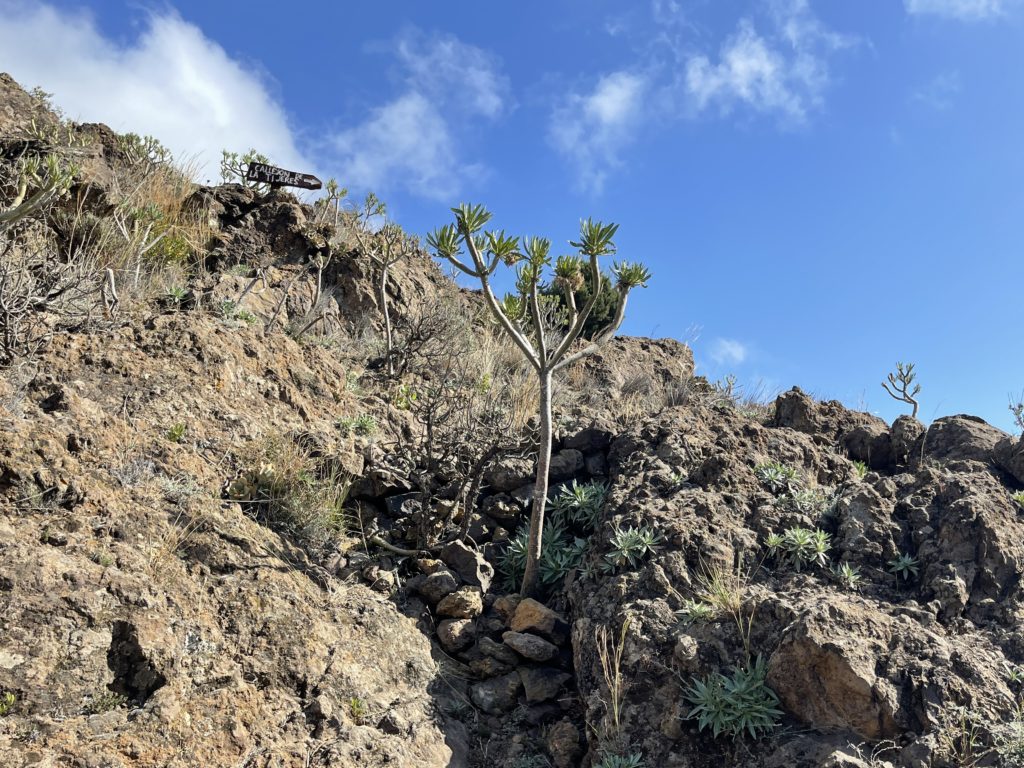
From Tinor, the path meandered through the forest, and I stopped at Quatro Escuinas where there was a fountain and a picnic table and I had morning tea. Then the path cut through scrubby grazing fields which were divided up with tumbling down walls (it was like Yorkshire), and I did see a couple of farmers. Eventually, passing San Andres, I made it to the Mirador of Jinama – apparently the very best views in all of El Hierro. But alas it was not to be as I had finally reached the altitude of the clouds, and that was it for views for the rest of the day.
From Jinama it was a nice stroll to Fuente de La Llania through lovely green damp forest. It was raining but I stopped for lunch at La Llania and had a cup of soup and some bread to warm up. And then another 4 km stroll in the mist with no views to Cruz de la Fuente. The winds were at about 35km, visibility was c. 20meters and there was sideways rain (my favourite kinds as it gets under the poncho).
By this time, I was soaking wet and pretty cold and it was 3pm. I decided to pitch up for the night and get warm. I (briefly) contemplated calling a cab and going back to my nice warm hotel room, but it is good for the soul to sleep in a tent. I pitched my tent (not well as it would turn out) and got into some dry clothes, cooked a hearty supper and drank tea and read books until 8pm then had a long sleep


Day 2 – Onwards to Sabinosa 10k, 400m up, 1200m down
Oh my, there is nothing quite like having to wring out your clothes and then put them on soaking wet on a rainy misty morning with 30km winds blowing. I had cheated and not brought my tent pegs with me (which means i can take all my gear as carryon). However that kinda required good weather, as my freestanding tent was pitched without stakes. That was an error in the rain, as my DIY option of trying to loop the ties around the neighbouring brush didn’t quite work, so the bottom of my tent was a veritable swimming pool, and in the middle of that pool were all my clothes (which to be honest would have been wet from yesterday regardless, but soaking wet was another matter entirely).
Oh well, nothing to be done. It is always tempting to keep your dry sleeping clothes on but that is always a safety error. If I wore my dry clothes they would be wet within five minutes anyway, and then i wouldnt have dry gear to put on if I needed to stop and bivvy.
I headed out into the mist and could literally see nothing. Apparently the views are epic, but I could only see about 20 metres in front of my face, and the rainy misty clouds were blowing hard at me sideways. Given there was nothing to see, I decided to detour down to Sabinosa early, via the El Pinar route, so that there would hopefully be better weather as I dropped down in altitude.
The path down was delightful – wet, green, and damp – but delightful. Mossy trees and lots of nice places that would have been good tent pitches. I stopped for a sodden cup of tea after about 7km at an old well. Eventually after descending 800m I finally made it below the clouds and there were some lovely views up and down the coast.
It was a nice meander into town, and I had called a taxi to pick me up in Sabinosa to the hotel, where I stood under the shower for 20 minutes to warm up and spent the afternoon trying to dry out all my gear – it was all totally sodden.


Day 3 — bonus day Mirador de Las Playas to the sea – 10km, 1200m descent
I was torn this morning whether to head back to redo some of the gr131 sections and hope for better views (the forecast was better) or head to the east of the island to try something new. I went east and that was the right call as we passed through the clouds on our way which were persisting in fogging up the highlands around San Andres but the sun came shining through as we arrived at the Mirador de Las Playas (look out point). The views were spectacular- so much so that my cabbie decided to stop for a cigarette and to take in the view too
From the mirador the trail meandered through farmland to another wonderful mirador a few km away in Isora. I saw two cars and one farmer in that 5km section. The view down to the rugged east of the island was mildly sickening – I have terrible vertigo – but the path was mostly well made. The trail dropped about 600m in 1.3km…. But it was mostly pretty stable even if steep
At one point I took a wrong turn and had to back track. I had missed the PR 3 as it required an all limbs to the ground scramble up a scree slope. I only figured it out as i saw a faint yellow mark at the top of the ridge. Oh well. I am not a huge fan of scree but I picked my way up the slope holding on to big rocks and hauling myself over a few boulders.
From there the path was poorly marked (thank goodness for downloaded gpx tracks) but I eventually found my way to the sea and the road . I arrived at the bus stop about ten minutes before one of the four daily departures to valverde, which was convenient as it avoided having to call a cab.


That’s it – I have to head back to work via Tenerife tonight and to London tomorrow
Valverde, El Hierro, January 8, 2022
Additional notes
Articles here and here, I used the Cicerone book – Walking on La Gomera and El Hierro, and the government has a good website
Buses are infrequent but reliable and moovit works well for planning public transport
Getting to and from El Hierro is a faff – either 2.5 hours on the Armas ferry from Los Cristianos on Tenerife (inconveniently not running Saturday. And the Sunday ferry gets you back to Tenerife too late for the London flight. Or you can take the Binter flight which goes to Tenerife North airport (a 40 minute drive or a one hour bus to the main airport at Tenerife south – where flights depart to London). Note Binter flights don’t appear on skyscanner. I ferried out and flew back but had to overnight in Tenerife before catching the flight home.
You must be logged in to post a comment.