The other trek I had wanted to do in Ladakh was the high altitude walk from Rumtse to Tso Moriro – not a technical trail but apparently one of the most stunning in the region. Arranging it was slightly problematic as almost everyone does this 100km on a group trek with horsemen, guides, and a cook, taking 8-10 days. Independent trekkers are discouraged, and solo trekkers are not allowed as the government only issues permits to two or more people. I was lucky enough to have my friend Rezin sort things out for me and come with me on the trek. I didn’t really need a guide (and he had never hiked this trek before), but given the remoteness, and the fact that garmin in reach devices are banned (so I can’t let hubby know that I am ok), it was great to have the company.
The trek covers 100km and never goes below 4200m, traverses 6 passes over 5000m, and requires at least one night sleeping at 5200m. As it turns out the weather was bloody awful, and as I type this, the ends of my fingers are still numb from the residual effects of frostbite on the trail. However, I loved it, and would consider going back to do it in better weather. Given it isn’t a technical trail, if you are fine at altitude, it is a great beginners trail.


Day 1 Rumtse (4260m) via Kyamar La (5071m) and Mandalchan La (5306m) to Tisaling (4940m)
25.44km, 6h30m of walking, 1175m ascent
Rezin picked me up in Leh at 5.30 and we drove the 2 hours to Rumtse admiring the views. As our last food stop for a few days, we stopped for Aloo Paratha, omelettes and chai at a small dhaba to fortify ourselves for the walk. We then headed out walking up a lovely easy valley from Rumtse to the first official campsite at Kyamar. The valleys are wide and lovely and we saw lots of the nomads horses grazing. It was an easy 2.5 hours to Kyamar where we stopped for a break and pondered why the tourist tents pitched had stopped so early in the day (probably to manage their acclimatisation).
Then it was a nice ascent up the Kyamar La until the rain started. By the top it was wet and cold, and we were amused to see a local shepherd at the pass with quite a natty umbrella. From the pass there was a nice ridge walk and then an easy descent to Tajurma Nala. We saw another small group pitched up the river, and we did go and check with them if they knew if there was water at the next campsite (which was a better place to sleep as it was lower). Water was a bit of a concern throughout the trail as climate changes mean sources aren’t as reliable as they once were. The guides congratulated us on walking ‘so far’ today (we had only been walking about 5.5 hours) and confirmed we were fine for water.
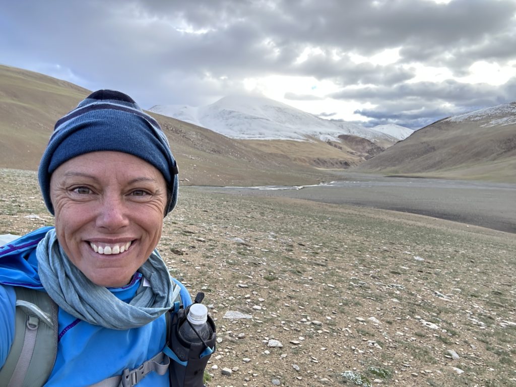
We headed up the Mandachala La, by the time I got to the top I was very cold with very painful fingers. Smelling the barn of the next camp site, I accelerated and fair ran down to Tisaling past some frolicking wild donkeys. We had the camp site to ourselves when we arrived at 3pm. Its always hard to pitch a tent without feeling in your fingers, but we got our tents up in the rain, I filled my water reservoir and retreated to my tent to warm up. It probably took two hours to warm up – aided by dry clothes, a hot meal, and three hot drinks. Dry feet are lovely. The rain pissed down consistently all night, and I pretty much did not leave the tent. The views of the day were lovely, though hard to photograph in the mist, but stunning.


Day 2 Tisaling (4940m) via Shibuk La (5275m) to Nurachan (4670m)
32km, 7h 30m of walking, 530m ascent
Rezin was up early at 5.20, and I woke up then too. We had tea and were blessed with about 20 minutes without rain. My tent was crunchy with ice and snow, and sadly it started raining before we rolled out tents up. Packing a wet snowy tent is a curse as you start the day with very cold hands, plus you end up carrying a lot of extra weight during the day (amusingly i had a lot of snow fall out of the tent when I unpacked it later in the day).
We left Tisaling at 6.20am to climb our only pass of the day – Shibuk La. I did a good job picking out the trail under the 10cm of snow that had dropped over night. But I lost the trail 200m from the top, and Rezin’s sharp eyes got us to the pass. At the top we were pretty much in full blizzard and the pass was a total white-out. Finding the trail down was a bit tricky with frozen fingers and a wet phone, so we took a rough bearing and headed down, assuming the trail would follow the valley down. I suspect the views were delightful but we could see bugger all. As we descended we eventually passed into the beginning of the Tso Kar valley – which was volcanic orange. I was very cold by the time we approached Ponganagu – and I was looking forward to the camp described in the book which had a tea-house. Hmmmmm, absolutely no tea house in sight, no shop, no nothing except for a winter nomad camp of empty houses. It was still raining, but I was cold, my teeth were chattering and I was shaking – and I was hungry as we hadn’t eaten breakfast so we decided to stop, even if we had to sit in the rain. I was delighted that Rezin figured out one of the houses wasn’t actually padlocked (just had the lock tied up with string), so we gently broke and entered into a nomads house to take shelter for an hour and eat and warm up.
We left at 11am and it was still raining, and the source we passed was dry. We only had about half a litre of water each, but it wasn’t hot, and it was still raining so we decided to chance it and assume there would be water in 18km when we arrived in Nuruchan. The stroll was an easy one, past the lovely misty Tso Kar lake. A few 4wds of tourists passed us by on the track, no doubt to check out the bird life (we didn’t see a single trekker this whole day). The views were limited given the mist but I was entranced by the lovely wild flowers.
We walked through a few nomad settlements – increasingly the traditional houses are being replaced by prefab buildings which look fairly fragile. But the traditional lifestyle endures. The walk was flat and easy, even in the rain, but I was slightly worried about water. So I kept an eye on the puddles thinking they might be useful later if I had to backtrack (it’s not the loveliest water source, but a puddle works if filtered)
We arrived in bleak deserted Nuruchan – a small winter village – around three pm and was super excited to see water in the river. We headed up stream a further 1km to find a nicer spot to camp next to the river, and were amused by a mad solo donkey who entertained us on the stroll by dancing around in front of us. Our tents were absolutely sopping wet (and mine had ice on it still), so we set up and retreated inside. It rained all afternoon, but I was reading Termination Shock which kept me entertained, and I had lots of tea to warm up. It was warmer, less windy, the day before, and we were 300m lower than the night before. Another lovely albeit bloody freezing day.


Day 3 Nurachan (4670m) via Kyamayura La (5416m) and Kartse La (5384m) to Gyamar (5157m)
24km, 6h 30m of walking, 1006m ascent
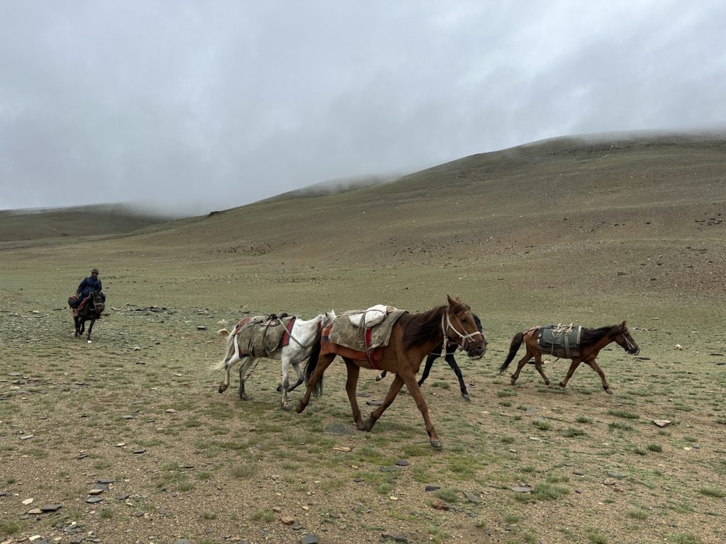
We were rolling at 6.15am, in a light rain, but but not miserable. We passed a big group of trekkers pitched 1km further on. They had 21 horses, 6 trekkers tents, a dining tent, a cook tent and a toilet tent. Am glad we didn’t see or hear them the night before. The horsemen are quite fascinating, and it is a short season for them to make their money – each horse costs £7 per day, and the horseman gets paid nothing additional.
We forded the river, mercifully keeping feet dry by rock hopping. From there it was an easy ascent to horlam La pass (4950m) – named for Chinese traders. And then an easy descent followed by a lovely stroll up horlam valley to the settlement at the base of Kyamayuri La. We covered this 10km in about 2.2 hours and we saw 7 trekkers leaving the valley up ahead as we arrived. The grunt up Kyamayuri La was fun. The trick to climbing at altitude is to do it slowly. We overtook one group near the top, it was a family and the teenagers were resolutely unhappy. They kept sitting down on the way up, and unlike us they were blessed with tiny day packs. (Rezin and I were carrying respectively about 17kg and 14kg).
We got to the top, at 11.15 and there was not much of a view, but joyfully the toughest part of the day was over. We descended down 250m to the Gyamar valley and strolled 3km along the river. We decided to pause for brunch and tea as there was finally a break in rain, and unsurprisingly it started to rain the minute we sat down. Oh well – warm tea, walnuts and an apple next to the river as we were rained on.
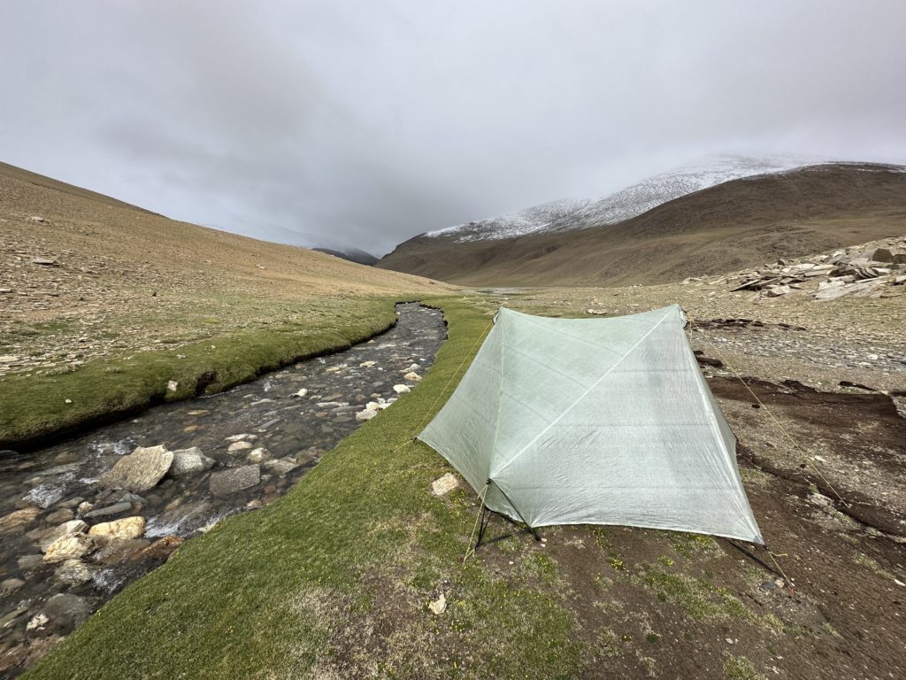
We had one final grunt up to Kartse La at 5430m and we arrived at 12.30. The views were misty but lovely. We were descending down to the river when a runner overtook us – one of the tour group workers who was making sure he arrived to reserve the best campsite. We met him again at the river and he told us he didn’t think there was water 1-2k further on where we were headed. He said his group would camp upstream so we went downstream and pitched next to stream.
We were pitched up by 13.30 and it was delightfully almost dry. We were both feeling pretty good given we were at 5157m of altitude. We had a lazy afternoon – more reading, tea, and eating. And I did go for a stroll down the valley in the afternoon, enjoying the dryness.
It was a slightly tough night – no headache or pain – but I suspect my brain was asking where the F was the oxygen when I was trying to sleep.


Day 3.5 Gyamar (5157m) via Yalung Nyau La (5435m) to Korzok (4552m)
19km, 4h 20m of walking, 330m ascent
Bloody amazingly I woke up to a glorious morning, and for the first time on this trek my tent was dry. Unbelievable. We headed out by 6am and it was an easy stroll up a wide and dry river valley. We then turned up a narrower valley for a 6km in increasingly narrow valley, gently ascending up towards the Yalung Nyau La. It was a lovely walk. The last 500m before the pass was covered in snow, and I was delighted to see snow leopard tracks (although I would have been happier to see an actual snow leopard obviously).
The pass was lovely and there were limited but nice views down to Tso Moriri. Sadly Mentok Kangri (the nearest large peak) was shrouded in cloud. We bombed down the final 10km to Tso Moriri Lake and Korzok village, motivated by the thought of paratha, chai and omelettes. The descent was initially crumbly on a dirty glacier, and then we crossed a very odd and large new road under construction up the valley, though we couldn’t figure out where it was going. It was a long 10km through the valley, taking short cuts on the scree to avoid the road. We finally arrived at Korzok which was quite a shit hole, with cheap prefab tent cities put up to cater for domestic tourists, and there was quite a bit of rubbish and some terrible rock music emanating from one of the hotels. Happiness did arrive though in the aloo paratha, omelette and chai at the tea house – so good in fact that we both demolished the first round and had another.
We went looking for accommodation – none of which looked promising. The village was full of generators and drills, with labourers rapidly throwing up cheap hotels. The recommended Tso Moriri camp was fully booked. We got a room at the Dolphin hotel (amusingly wondering where the dolphins were in Ladakh) and I probably had the best view in town – with two enormous picture windows. Sadly though there was no electricity, so I had to make do with a bucket of hot water for a shower – which was still pretty amazing.
After cleaning up, I walked to the lake, dodging yaks and surreptitiously opening some gates to sneak through. I didn’t see anyone else on the shore when I was there and later I only saw a handful of tourists go down there for sunset. Most tourists just take a photo from a distance.
I had an afternoon lay about, cleaned some gear and read my book. When sun set came, I hiked up to the Gompa with Rezin for some awesome views of the lake with amazing clouds. Dinner was a buffet at the hotel, and then a good nights sleep.


Day 4.5 Chilling in Tso Moriri and heading back to Leh
So the upside of walking to korzok is only need to do the six hour ride once between Korzok and Leh. Anchok picked us up at 10 (having left Leh at 4). It was a glorious sunny day and Rezin and I consoled ourselves it would have been too hot to hike in sunny weather. The drive was amazing, incredible clouds, lots of nomad settlements and chortens. The final part of the drive was a wonderful 150km alongside the mighty Indus river.
I checked back into my home away from home at the Chospa hotel, had a wonderful hot shower, and then went for dinner at the reliable Lamayuru restaurant. I also may have popped into Lena Ladakh and Lee Vallee to buy more pashmina – no comment (these are wonderful shops if you are in town, owned by Ladakhi women).
And so ends a wonderful 3 weeks in ladakh. I would definitely recommend a visit, and if you do come, Rezin is an excellent guide and has a cab if you need support. You can contact him on +919622996469


Leh, Ladakh, July 13, 2023
You must be logged in to post a comment.