I was in Scotland after a board meeting with three days to spare and an acceptable weather window, so I decided to utilise the services of the wonderful Rory (Scotland’s best cabbie) to drop me off at Glen Affric so I could walk 100km over to Glen Dessary. I love Scotland but she sure does make you work for her affections – it was a classic Scottish walk – tonnes of midges, ticks, cleggs, bog, butt sliding, and rain. But it was still lovely!
Day 0 – Glen Affric car park to Loch an Fheadain 9.8k, 190m ascent
Rory dropped me off at the Glen Affric carpark at 8pm, and I figured I had a couple of hours of daylight to get a start on the Affric Kintail trail. As it turns out, the bulk of the trail is well groomed 4wd estate tracks, so I managed 10k before pitching my tent on some soft but uneven bog at a tiny loch with lots of midges for company. I managed to get about 100 bites in five minutes, so cooked dinner in my tent at 10pm, holding the stove between my feet, amused by the big label inside the tent saying – ‘do not EVER burn fuel inside this tent’


Day 1 – Finish the Affric Kintail trail to Morvich……
Scottish daylight is an excellent alarm clock. I was up at 5am and wandering by 6am. It was a ovely easy walk mostly on estate tracks past the UK’s most remote youth hostel at Alltbeithe. The path got more interesting heading through Fionnglean as it dropped to a foot trail, and I stopped for a coffee at the cute bothy at Camban. The last 7k (of the 22k) to Morvich were an easy stroll along another farm track, where I finally passed two humans after a very quiet morning


Day 1 (cont’d)…. and then over to the ford at allt a choire reidh (total 38k, 1020m ascent)
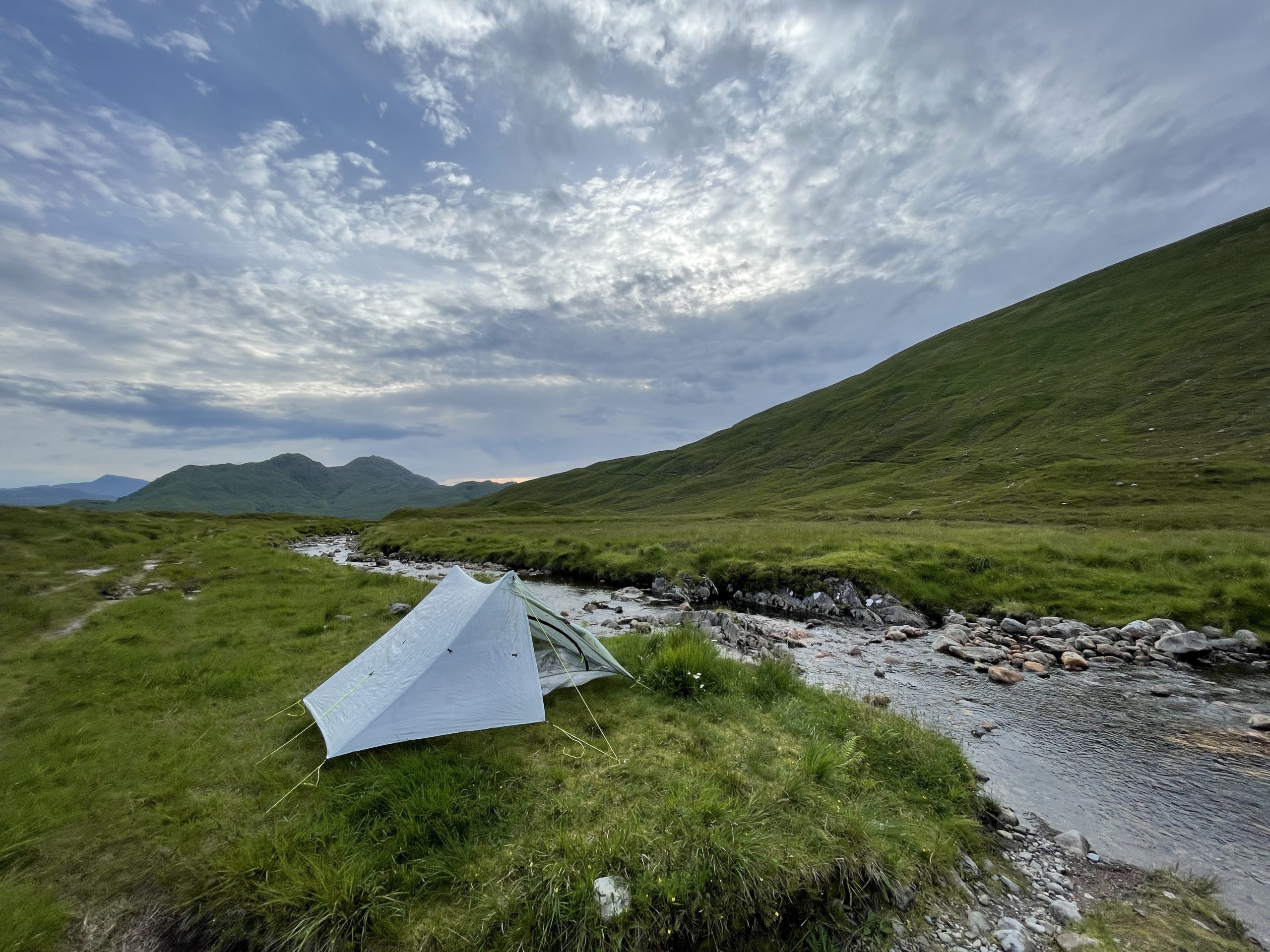
I arrived at Shiel around 12.30, visiting the excellent Kintail crafts for some supplies, and then going to the bun shop for some carrot cake. I also checked the news – as it was the only 30 mins of 3g signal I would get all weekend. The sun was shining so I began the hard , hot and slow boggy grunt on the pathless climb up the Meallan Odhar – which was worth it for the views. Absolutely stunning. The rain came in as i was navigating the rocky Forcan Ridge up to the Bealach Coire Mhalagain, and I had a slippery slide (with some butt to ground moments) down the Allt Coire Mhalagain. I hit the ford at Allt a Choire Reidh at 8pm and decided to call it a day as I knew where were no good camp sites for another couple of hours of walking. The rain stopped, the breeze picked up and kept the midges away, so I enjoyed the view while drinking tea and eating a substantial supper (i love dehydrated meals with doritos sprinkled in).


Day 2 – Down to Sourlies via Barrisdale (31.5k, 1120m ascent)
I slept in this morning until 6am and read my book before a slow start at 8am. I didn’t think it would be a long day. The meander down to Kinlochhourn was easy – it is a tiny settlement with a few houses on the estate and a tea room which was closed when I passed at 9am. Then began the undulating trail along the stunning sea loch to Barrisdale. It looks kinda flat on the map, but was 500m of ascent and relatively sweaty – so I stopped for a cup of tea at a stream.
I stopped again for lunch around 12.30 at the bothy at Barrisdale and had a lovely chat to a man who had kayaked in there with some family. They were exceptionally well supplied, so I was the lucky recipient of an excellent flapjack. Three sodden hikers rolled in aroudn 2pm, knackered and soggy from the walk over from Sourlies, and they looked surprised that I was headed that way for the evening. I roused myself and headed out in the rain which didn’t stop for the rest of the day.
The path up to Mam Underlain was excellent – a glorious glen with a steady ascent (no photos as too rainy). However the route down the other sdie to the River Carnoch was a pathless bum slide with sketchy rock sidles to avoid some of the bluffs. I reminded myself that I had broken my wrist on terrain like this in Wales, so I was being careful.
I was relieved to hit the river, hoping for a better path. It was a false hope….. my feet were under water for the final 6km slog to Sourlies bothy – dodging waist deep bogs. Sourlies was a lovely sight – the most remote Bothy in Scotland. It was worth it – even in the rain. The bothy had four inhabitants, so I pitched my tent, but cooked in the bothy and had a chat. And then I drank hot chocolate in my tent, watching the slugs try and climb the outside of my tent, and watching the deer wander along the shoreline. It was worth the boggy rainy slog.


Day 3 – Out to Glendessary (23km, 780m)
It rained all night – beating like a drum on the tent, but I was very dry and cosy inside. I had arranged for Rory to pick me up at 4pm, so I didn’t leave Sourlies until 8am figuring the 15km (which turned out to be longer) wouldn’t take too long.
There was bog, soggy path, mud, and a bit more bog. And the rain did not let up the entire day. The view down the Finiskaig river to Sourlies is amazing on a clear day, but was still pretty lovely on a rainy day. I cheered myself up by having some instant hot mash at the lovely loch at Mam na Cloich Airde. And then I got lost as my phone wasn’t working well in the damp, and ended up doing a 2km boggy pathless traverse when I could have exited Glen Dessary on a perfectly good 4wd track – oh well, best study the maps in advance next time.
I arrived at the road end at around 14.30 – the bog, rain and navigation had slowed me down. Three lovely yorkshire train drivers arrived on very nice motorbikes and we had a chat – and they gave me some shortbread (advice to hikers – always take treats from strange men in remote locations ;-)) which I ate with the rest of the leftovers in my pack. They headed off, and as I was still early for Rory, I started walking down the road to civilisation at 3pm, and met Rory on the road at 3.45pm. I was soaking wet…. but happy.


I love Scotland, and love that I can get a proper wilderness weekend in without too much effort. Rory (whatsapp +44 7525 234471) is terrific as he will drop me off, and I know he will be at whatever random coordinates I have given him at the specified time for a pick up. I had no signal outside of Shiel bridge, but did carry a Garmin inreach in case of emergencies. The route was a combo of the Affric Kintail trail and part of the Cape Wrath route from Shiel to Glenfinnan – all easily followed on OS maps. Don’t forget smidge and skinsosoft. I also took a midge headnet which I didn’t use. Lots of other hikers had problems with ticks but I didn’t see any.
24 July 2022, Inverness
Great pics as usual