This is the first winter in years where I haven’t retreated to the Southern Hemisphere to go hiking and I desperately needed some long days walking and some tent time. I did my homework and decided to give the Canary Islands a go. They have never been high on my holiday list (although I have been previously for work), as I imagined them to be overrun with package tourists. However there are some epic trail races on the islands and the weather should be great as the islands are only a few hundred miles off the coast of Africa.
I am headed to La Palma, which has the most rugged terrain. The plan is to do the volcano route from Fuencaliente to Tazacorte (about 70Km), and a few routes in the national park of Caldera de Taburiente (about 40km) over a total of four days. I have my tent and a permit to sleep in Taburiente for one of the nights and will make up a plan for the other nights on the fly
I came to La Palma via Gran Canaria airport (which was candidly my idea of hell, heaving with package tourists) and I hoped like hell La Palma wouldn’t be the same. Arriving at La Palma the excellent taxi la Palma were there to pick me up and had bought me a bombona (gas canister for my stove), as it is the one thing you can’t fly with. He dropped me at the hostel in Fuencaliente, a bargain 30 euros per night for a private room with bath, albeit not much in the way of soundproofing, and I grabbed some supplies from the shop and hit the sack.
Day 1 Fuencaliente to Puenta de las roques (32km, 2200m of climbing 17kg pack)
I got up at six-ish and finally left at 7 in the pitch black with a head torch on. The sun doesn’t come up until 8, but I knew it would be a long day and the early bit wasn’t that scenic on the map.
It’s been so long since I hiked with 17 kg on my back that I have forgotten how hard it is!!!! All my gear is very light but I was unsure what conditions would be like on the tops so had bought a winter tent (1.8kg vs my normal O.4kg), and spikes for the snow (0.3kg), but nothing can make water ultra light and I wasn’t sure there would be water for the whole route so I took 6 litres with me! It was bloody heavy hauling it up the hill (and unsurprisingly I was over prepared but better to have than not have)


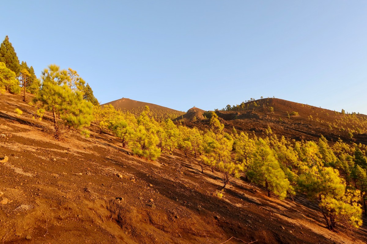
With the sun on my back I eventually got in a rhythm, albeit a really slow one as I slogged up the hills. I had the first three hours in blissful solitude. I had succumbed to putting some music on and was singing away happily to myself really enjoying the views when I passed the first of the many day hikers I would see coming the other way. I lost count at 60, by the speeds they were going I didn’t expect them all to make farocaliente before dark. The landscape is surreal and alternates between pine forest and pitted volcanic craters and pointy mountains. The nicest peak was The Volcan of Deseado which I could see for most of my day, it’s a distinctive point on the southern part of the islands spine


I made it to El Pilar (after about 18km and 1400m of climbing or 450 flights of stairs according to the Garmin and 500m of descent) just after lunch where it turns out there is a tap so I carried an extra 4 kg for 18 km for nada. But I still need it for the next leg. Even better there was a snack truck! Two Aquarius (an excellent nonfizzy Spanish soft drink) , a cafe con leche, a hot dog and half a packet of biscuits later and I was a new woman!

After snoozing in the sun for a bit I strolled the 6km rolling path to reventon which was nice and easy as it was all in the forest. I stopped for a break and some food again when I got there (it took me an hour and a half, I swear I have never walked so slowly!). Apparently there is a good natural fountain at Reventon but I didn’t see it
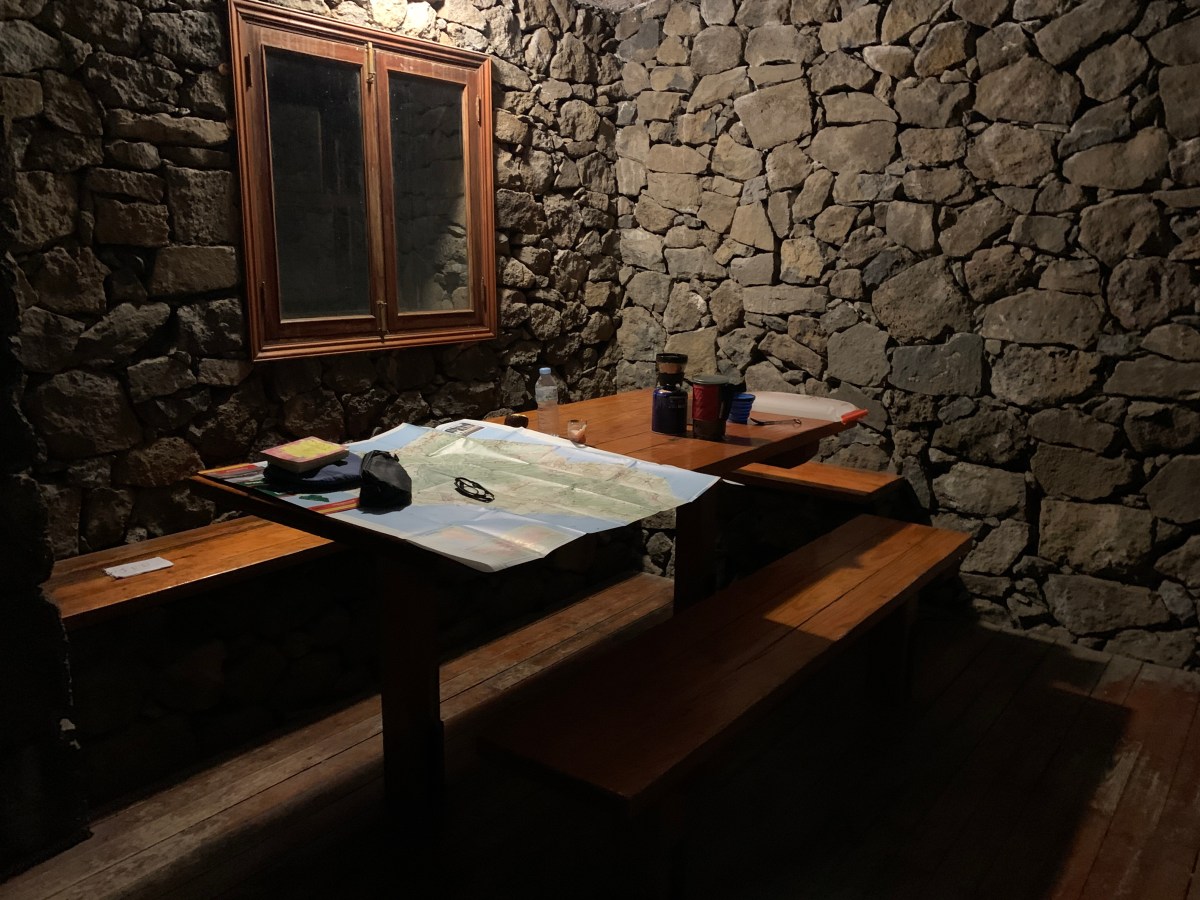
After that it was a slow grunt up the final 700m climb over 6km to the punta de Los roques, punctuated by many breaks ostensibly to check my email, but really cos I was knackered. I saw the refugio de Los Roques peeking through the trees with the setting sun shining on it and I tried not to be too hopeful it was empty or not crowded. I was happy to tent but it was going to be cold at 2000m and I hadn’t seen too many flat spots. I eventually made it up the hill and the refuge looked delightful and was happily inhabited by a solo danish guy. So more than enough room for me (it probably sleeps 16 or 20 at a push).


I set about hydrating, soup, decaf coffee, hydration fluids, cooking and eating in front of the refugio watching the amazing view. The sun went down and the light was breathtaking on the caldera. A bit more food and a good gossip with Soren (environmental law professor from Copenhagen) and we retired to bed at 8pm after checking out the stars (which are quite famous here as there is limited light pollution)


I had a mild fright at 10.30 when I woke up with someone crashing through the door of the refugio. Two spanish guys who had had a long day, they were suitably quiet while they ate and went to sleep so I managed to get back to sleep for awhile until one of them started making the weirdest snoring noises I have ever heard. I thought he was going to die as he kept stopping breathing. I gave up trying to sleep at 6am and got up to have a leisurely breakfast.

Day 2 Refugio to Mirador El Time and then a shower (29km, 900m ascent, 2400m descent, 15kg pack)
The sun started to peak through the darkness around 7.15 so I went outside with my coffee for an epic sunrise with a stunning view of Tiede summit on neighbouring Tenerife.

I strolled out slowly at 7.30 less weighed down than yesterday but it was slow going. The route was stunning, for the first two hours I saw no one and the views out to the caldera with the sun hitting them were amazing. The walk meanders up and down the spine of the island though in most places the ridge isn’t narrow enough to give any cause for concern but I wouldn’t want to be up here in the fog.


At some point after Pico de la Nieve the route comes close to the road and car parks, so I started running into ill equipped tourists skidding on the trails which were a tricky blend of sand, volcanic rubble and scree and rocks. I was already tired, so found a quiet spot to take a break and cooked up an early lunch.


It took me quite a while to hit the summit of Roque de los muchachos at 2430m, every summit was a false one, and I was low on water and thirsty. And I took a lot of breaks! When I did get there I didn’t stay long as there were about 500 tourists. There was a water tap next to the information booth marked ‘agua non potable’ which technically means it’s not drinkable but I was desperate. I had a litre and then saw the ranger and asked him if itnwas drinkable. He said they mark it that way to deter the tourists from drinking it, but the hikers ‘should know’ it’s ok as they block the tap if there is a problem (hmmmm not sure how I would have ‘known’, but was grateful nonetheless).

I left the summit at 13.30. My original plan had been to hike all the way down to the coast and then back up into the caldera. Checking out the map, the section from el time to Los llanos was entirely urban and not pretty and the route up from los llanos looked long and hot. So I decided to hike down to el time, bus to Los llanos and sleep in a hostel for the night for a shower and then head up to the caldera the next night.

That plan though did mean I had to book it down the hill to get the bus. It wasn’t far – 16km, but it was a 2200m drop. The path was rocky and while it eventually dropped under the tree line and had shade, the shade came with very slippery pine needles. The views on the first 8k were epic though, and there were very few people

The last 4km down (with 450m of descent) from the Torres to El time was interminable and without redemption. Rocky, steep, no shade, no view, and just the type of gradient where your toes get slammed into the front of your shoes (I’m pretty sure both big toe nails will be dropping off in a month). The only positive I could find about this interminable section was that at least I wasn’t walking up it. I had a mild sense of humour failure about 1km before the end as am sunburnt (forgot sunscreen and a hat) and was thirsty, so I stopped and downed my last litre of water and hoped like hell there was water at EL Time. Better than that, there was a bar with homemade cake. Two more Aquarius and an awesome slice of the owners banana caramel cake, and I whiled away 45 mins waiting for the bus to Los Llanos (and yes I know I can afford a taxi but I like buses)

Ok the bus was late, but I did get chatted up by a retired Swiss farmer on the bus who rents a room down here for six months in the summer. He was worried about me so walked me to the hostel. The hostel Vagamundo was all I needed, not as good value as Fuencaliente as it is shared bath and I had to rent a towel for €2, but €30 is fine. Then off to the important business of getting some fluid and calories in – off to the Argentinian steak house!
Day 3/4 into the caldera
After the gr131 the most recommended hiking on the island is in the caldera de Taburiente, you can hike into the crater and then take different routes up the sides. I had a campsite booked (free, see below) and had a plan for different hikes). After a leisurely 6km stroll into the camping from the mirador los brecitos, I was checking in and the ranger told me all the routes were closed due to landslides. I feel like this is the universe’s way of telling me to have a day off, so I pitched my tent, made some lunch and spent the afternoon reading and intermittently admiring the views


When I arrived this morning there was a loud party of Spanish people leaving – around ten of them with shiny gear, and I was hopeful they wouldn’t be replaced. Fortunately the campsite is vast and I pitched at the remotest end with the best view. I did go for a late afternoon stroll to check out the hills in the afternoon light and there was one other couple camping about 200m away, but still blissfully peaceful

After an excellent and quiet sleep I extricated myself from my tent to watch the sun come up, had a coffee and slowly packed up. It was a delightful walk back to Los brecitos, though I passed about 20 people on their way in, and on the way back to Los Llanos I passed ten heaving van loads of tourists on their way to the trail so I had made a good choice on what day to visit (apparently Sunday is always quiet as the tourists go to the market)


Day 4 afternoon chilling in Los Llanos
I spent the afternoon strolling around the lovely town of Los Llanos, stopping from time to time to have some tapas and a drink! There isn’t much to do but it’s quite lovely. I will be back as the hiking here is excellent and the infrastructure works quite well (taxis will drop off and pick off easily at trail heads and the buses work well).

Los Llanos de Aridane, December 30, 2019
Additional info
- Water is the most problematic part of La Palma at least on the volcano route, so plan accordingly
- Paddy Dillon’s cicerone guide to walking on La Palma is a good one, but is more set up for day walkers than long distance, and it doesn’t helpfully outline water sources
- Senderosdelapalma.es was an excellent resource and had most of the gpx trails to download
- Buying gas for my stove was my one issue that I couldn’t figure out, so I asked the taxi company to buy me some and bring it with them to my airport pick up, and tipped them generously as it saved me a lot of hassle. ww.taxilapalma.com. (Note it turns out cooking of any kind is illegal in the national parks.). They also provide drop offs to trail heads, or if you have more time and less money the island bus service (guaguas) is excellent https://www.tilp.es/regular/
- It’s easy to book a campsite in the caldera de Taburiente for free, and bookings open 15 days in advance https://www.reservasparquesnacionales.es/real/ParquesNac/usu/html/inicio-reserva-paso2-oapn.aspx?cen=4&act=%202
- Mountain weather forecast for the high route here (I was worried about snow when I went, as it has happened in December before)
- Stayed at the hostel pension in Fuencaliente and the hostel vagamundo and hotel benohoare in los llanos
Such a nice way to end a year and walk into the new one. Inspiring, once more. Happy New Year!
thanks Maureen, hope all well with you and you are getting some miles in also 🙂